MEXICALI
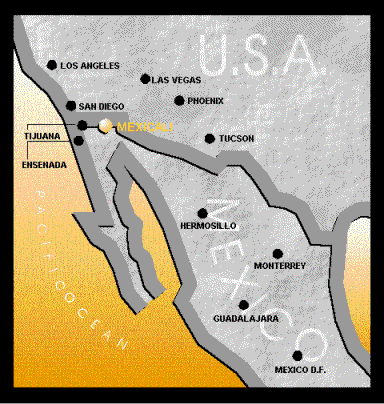
Mexicali is the capital of the state of Baja California, México.
Our city is located in the northeastern section of the Baja
California peninsula, bordering with the city of Calexico, CA.,
in the Imperial Valley, part of the Imperial County, CA. Mexicali
county extends through 5,400 square miles, covering 20% of the
state's land surface. Our city was founded in 1903, and since its
origin it has distinguished itself by receiving and integrating
to its community hardworking people coming from all over México
and the world in search for better opportunities.
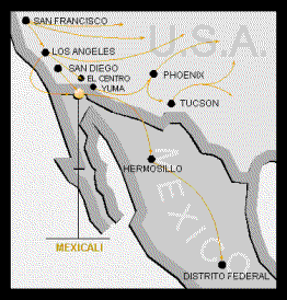
Due to its unique location, Mexicali is well
positioned as an import/export hub between the Pacific, North and
South American markets. The Universal Group considers its
location to be an asset in delivering our products to our
domestic and international markets.
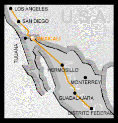
Freight Transportation
There are several ways to access Mexicali. By road coming from
the United States. A main advantage is rapid access to the wide
network on Interstate freeways and highways that run throughout
the neighboring State of California. Among the main routes
readily approachable we can mention Interstate 8, just seven
miles from the border, which west an east-bound traffic
represents an important avenue of transportation to both the
western an eastern halves of the continental USA; Interstate 10
just a few miles further north, gives access to the northern
parts of California and other northerly States, passing through
the Los Angeles Metropolitan area adjacent communities.
 Air
Transportation
Air
Transportation
Mexicali's International Airport, "General Rodolfo Sánchez
Taboada", is located 20 Kms. east of the city and offers
services to all types of flights, private and commercial. There
are daily flights out of the Airport to other major cities in
México. In addition, we have access to the Imperial Valley
Airport, 15 miles north across the border from Mexicali which
operates commercial flights to different cities in the United
States.
 Railroad Transportation
Mexicali's railroad network is 131 Kms. long, 71 of which
correspond to main routes, 39 Kms. to auxiliary routes and 21
kms. to private routes. The railways that cross this municipality
are joined to the Pacific Railroad, with is linked to the
Chihuahua-Pacific Railroad and the National Railway Network of
México.
 Sea
Transportation
Sea
Transportation
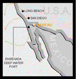
In regards to sea transportation, Mexicali has access, within a 5
hours drive, to the San Pedro-Long Beach harbor, and on the
Mexican side, within 3 1/2 hours to the port of Ensenada. Both
harbors allow for shipping to ports throughout the world.
For more specific information or information
regarding prices and or delivery contact us by e-mail at: service@universalgroup.com
[ Home | Feedback | Search
]
Send mail to CompanyWebmaster with
questions or comments about this web site.